
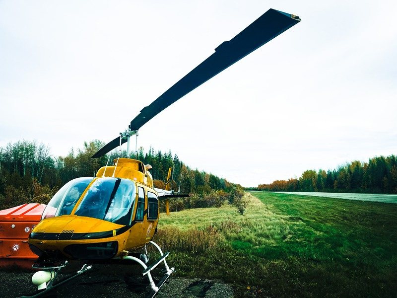
Aerial intelligence when time matters
rapid-ortho turns a single pass into georeferenced, analysis-ready imagery, processed 100 times faster than traditional imagery. It works across snow, ice, open water, and dense forest.
For Canadian military, defence, and emergency-response teams, and the prime contractors who support them.
How we help defence teams get aerial intelligence fast
ProDelta’s rapid-ortho turns a single aerial pass into georeferenced, analysis-ready imagery 100 times faster than traditional imagery processing, across snow, ice, open water, and dense forest, with AI detection that flags objects and changes.
Rules last checked . Most recent change: Responsibility for Canada’s Industrial and Technological Benefits Policy moved to the Defence Investment Agency in July 2026. This is a plain-language summary, not legal advice.
- How much faster is it?
- rapid-ortho processes imagery 100 times faster than traditional imagery processing, and can process onboard during the flight so imagery is ready when the aircraft lands.
- What is the Industrial and Technological Benefits Policy?
- Canada’s Industrial and Technological Benefits (ITB) Policy asks companies that win major defence contracts to carry out business activity in Canada equal to the value of the contract. ProDelta is a Canadian-owned supplier whose Canadian content has been independently calculated. A third-party ITB alignment report is available on request.
Canada’s hardest terrain is where traditional sensing slows down
Decisions in the field are only as good as the imagery behind them, and how soon it arrives. In snow, over water, and under dense canopy, conventional sensing can need extra passes, long processing, and costly equipment.
When intelligence arrives late, it stops being intelligence.
- Snow and iceLiDAR and photogrammetry can struggle on reflective, low-texture surfaces, so winter surveys can be unreliable.
- Open waterWater surfaces can return thin or unreliable data, which can force re-flights.
- Dense vegetationBoreal forest and riparian zones can demand costly, high-density scans and slow processing.
- Slow processingHardware-heavy workflows make same-day deliverables hard on large areas.
- Complex collectionPre-planned grids and rigid collection windows limit when and where you can fly.
- Costly sensorsPurpose-built sensor packages limit which aircraft and teams can use the capability.
rapid-ortho: simple, fast imagery
- All-condition collection. Built to collect usable imagery across snow, ice, open water, and dense vegetation, in any season.
- Any sensor, any platform. Works with any camera that meets standard geospatial parameters, on manned or unmanned aircraft.
- 100 times faster processing. Processing runs 100 times faster than traditional imagery processing and can happen onboard during the flight, so imagery is ready when you land.
- Simple collection. Turn the sensor on and fly. A single pass gives full coverage, with no pre-planned grid and no high-overlap passes.
- AI detection. Deep machine learning detects, classifies, and flags objects and changes, so manual review takes minutes instead of hours.
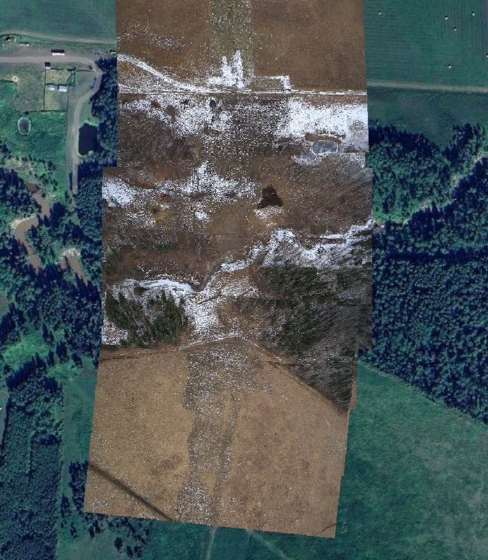
Where speed changes the outcome
The faster imagery becomes intelligence, the more it is worth.
Surveillance
Continuous wide-area monitoring of borders, pipelines, and critical infrastructure. Change detection flags unauthorized activity between collection cycles, with no manual comparison.
Situational awareness
Georeferenced imagery delivered within hours, across complex terrain, adverse weather, and changing seasons.
Disaster relief
Rapid deployment to flood, wildfire, and other disaster zones. Full-area coverage in a single pass gives emergency coordinators current ground intelligence within hours of an event.
Intelligence
AI classification of objects, features, and terrain changes, delivered as analysis-ready outputs that work with existing GIS and command platforms.
Canadian by design
Canada’s Industrial and Technological Benefits (ITB) Policy asks companies that win major defence contracts to carry out business activity in Canada equal to the value of the contract. ProDelta is built to support that goal.
Canadian-owned
ProDelta is 100% Canadian-owned. Operations, supply chain, and partnerships are based in Canada.
Research in Canada
All research and development is done in Canada by a dedicated in-house team. The technology is at technology readiness level 6 (TRL 6) and operationally ready.
Skills and training
Work-integrated learning, summer student programs, and a dedicated First Nations Skills-Building Program build Canadian geospatial and AI talent.
95.23% Canadian content value
Independently calculated using the Cost Aggregate Method, and third-party verified in 2025. A third-party ITB alignment report is available on request.
Source: ProDelta ITB overview (March 2026) and Innovation, Science and Economic Development Canada, ITB Policy pages. This is not a government certification.
Part of one connected system
rapid-ortho captures the imagery. genesis-ei reads it for terrain, vegetation, and change, and geo-story turns the results into a clear story for decision-makers.
Questions we hear
What is rapid-ortho?
rapid-ortho is ProDelta’s aerial imagery software. It turns a single pass from a manned or unmanned aircraft into georeferenced imagery and processes it 100 times faster than traditional imagery processing.
How much faster is it?
rapid-ortho processes imagery 100 times faster than traditional imagery processing, and can process onboard during the flight so imagery is ready when the aircraft lands.
Does it work over snow, ice, open water, and dense forest?
rapid-ortho is built to collect usable imagery across snow, ice, open water, and dense vegetation, where LiDAR and photogrammetry can need re-flights or produce unreliable results. Ask us about your terrain and season.
Can I use my own sensor and aircraft?
rapid-ortho works with any camera that meets standard geospatial parameters and can be deployed on manned or unmanned aircraft. We confirm compatibility with you before a program starts.
What is the Industrial and Technological Benefits Policy?
Canada’s Industrial and Technological Benefits (ITB) Policy asks companies that win major defence contracts to carry out business activity in Canada equal to the value of the contract. ProDelta is a Canadian-owned supplier whose Canadian content has been independently calculated. A third-party ITB alignment report is available on request.
Where does ProDelta work?
ProDelta works across Canada from offices in Calgary, Fort St. John, and Nanaimo.
See your area, fast.
Tell us your terrain, aircraft, and timeline. We’ll show what a single pass delivers.