
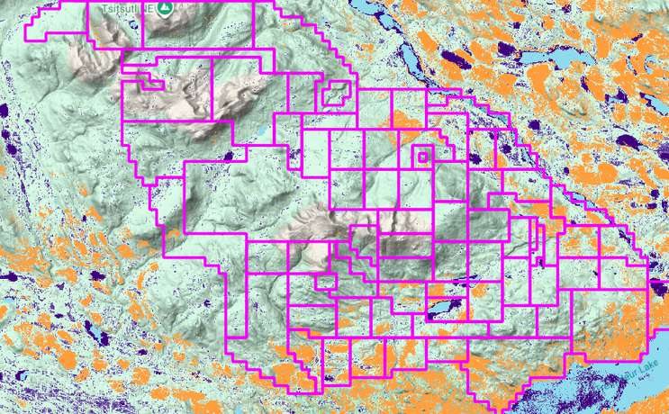
Wildlife and habitat monitoring
See where species live and move across your project area before the permit conversation starts, and keep that picture current.
For proponents, planners, regulators, and land teams working in caribou, moose, wolf, and bird habitat.
How we help you see habitat before permitting starts
genesis-ei maps wildlife occupancy, species at risk, and movement corridors in minutes, so teams see habitat constraints before routes and layouts are fixed. It supports qualified biologists. Field surveys still verify conditions.
Rules last checked . Worth knowing: Under the federal Migratory Birds Regulations, 2022, most nests are protected only while they hold a live bird or viable egg, with year-round protection for 18 listed species. This is a plain-language summary, not legal advice.
- Does it replace field surveys?
- No. It shows where to look and what is likely there. Field surveys by qualified biologists still verify conditions, and a fully verified baseline adds ground truthing.
- How does this relate to Alberta caribou plans?
- Sub-regional plans set limits and restoration expectations across caribou ranges. A current baseline helps you see where those limits will affect your project. See our page on Alberta caribou sub-regional plans.
Habitat data is patchy and ages fast
Projects are judged on what they do to wildlife, and species at risk can limit where and when work happens. Survey data is expensive, seasonal, and often years old by the time a decision is made.
Reviewers, communities, and proponents need to look at the same picture of where animals live and move.
- Species at riskListed species and their critical habitat can set hard limits.
- Seasonal windowsNesting and calving seasons restrict when work can happen.
- Plans with limitsCaribou and biodiversity plans set footprint and restoration expectations.
- One shared pictureWithout common evidence, every party argues from different data.
The rules that shape wildlife and habitat work
Wildlife is protected at every level of government. These are the main requirements this monitoring helps you evidence.
Federal
- Species at Risk Act. Prohibits killing, harming, or harassing species listed as extirpated, endangered, or threatened, and protects critical habitat. Permits may be possible for some activities.
- Migratory Birds Convention Act. Protects migratory birds, their eggs, and nests. Under the 2022 regulations most nests are protected while they hold a live bird or viable egg, with year-round protection for 18 listed species.
British Columbia
- Cumulative Effects Framework. Provincial assessments cover values such as grizzly bear and forest biodiversity, and guidance helps applicants judge their contribution to risk.
- Wildlife Act. Protects nests of birds, which clearing has to avoid.
Alberta
- Caribou sub-regional plans. Planning under the Alberta Land Stewardship Act sets footprint guidance, restoration expectations, and reporting across caribou ranges. Statuses vary by plan.
Sources: Environment and Climate Change Canada (nest protection fact sheet; Species at Risk Public Registry guidance), Government of British Columbia (CEF guidance, April 2026), Government of Alberta (sub-regional planning, late October 2026). Plain-language summary, not legal advice.
Habitat, read at landscape scale
ProDelta supports qualified biologists. It does not replace field surveys or professional judgment.
- genesis-ei maps wildlife occupancy for species such as moose, caribou, and wolves, plus species at risk and movement corridors, with an initial analysis in minutes.
- Vegetation and canopy layers show cover, canopy height without LiDAR, and biomass that shape habitat.
- rapid-ortho checks high-priority areas with high-resolution imagery for ground truthing.
- geo-story shows habitat evidence in context for regulators and communities.
What you walk away with
Early constraint map
Where habitat limits are likely, before routes and layouts are fixed.
A baseline that updates
A repeatable record to show change after work and restoration.
A shared view
One picture proponents, regulators, and communities can all read.
Related land monitoring topics
Wildlife depends on vegetation, water, and the footprint around it.
Questions we hear
What species does it cover?
genesis-ei maps wildlife occupancy for species such as moose, caribou, and wolves, plus species at risk and movement corridors. The list of indicators is 15 today and growing.
Does it replace field surveys?
No. It shows where to look and what is likely there. Field surveys by qualified biologists still verify conditions, and a fully verified baseline adds ground truthing.
How fast is the analysis?
An initial landscape-scale analysis takes minutes, not the months or years of a traditional baseline study.
How does this relate to Alberta caribou plans?
Sub-regional plans set limits and restoration expectations across caribou ranges. A current baseline helps you see where those limits will affect your project. See our page on Alberta caribou sub-regional plans.
Which rules apply?
Federally, the Species at Risk Act and the Migratory Birds Convention Act. In British Columbia, the Cumulative Effects Framework and the Wildlife Act. In Alberta, sub-regional plans. Check requirements with your regulator.
See the habitat before you commit.
Tell us about your project area. We’ll show what wildlife layers reveal.