
Alberta caribou sub-regional plans
New limits on footprint, new restoration timelines, and new reporting are coming to caribou ranges across Alberta. Know where you stand before the plans take effect.
For Alberta energy, forestry, and linear-infrastructure operators, and the teams that report for them.
How we help operators prepare for caribou sub-regional plans
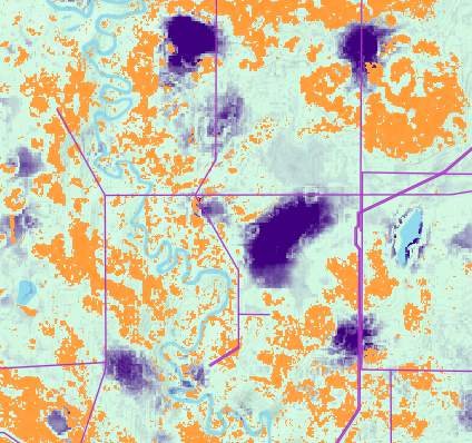
ProDelta maps habitat, disturbance, and restoration priorities across a plan area, so operators can see where footprint limits and restoration expectations are likely to apply before a plan is final. genesis-ei gives an initial analysis in minutes and tracks change as plans take effect.
Rules last checked . Most recent change: Upper Smoky came into effect in November 2025. Engagement on the South Athabasca draft concluded in April 2026, engagement on the Caribou Mountains and Red Earth drafts closed on October 26, 2026, and Berland engagement is open until November 12, 2026. This is a plain-language summary, not legal advice.
- What is the status of the South Athabasca Sub-regional Plan?
- Alberta released a draft in December 2025 and took public input from January 9 to April 9, 2026. Engagement results are under review and updates to the draft are being considered. The plan would replace the Cold Lake Sub-regional Plan and, to be enforceable, its regulatory details would be added to the Lower Athabasca Regional Plan.
- How can genesis-ei help me prepare?
- genesis-ei already holds a sub-regional baseline and monitors 15 ecological indicators, and growing, including wildlife habitat and canopy height, so you can see how your footprint sits against each plan, plan with the Environmental Priority Pathway, and track disturbance decade by decade. rapid-ortho adds site-specific imagery for linear features, with AI image classification to support regulatory reporting.
New rules. New deadlines.
Alberta is writing sub-regional plans across the province while it pursues its goal to double oil and gas production. Once a plan is finalized under the Alberta Land Stewardship Act, its requirements apply to everyone operating in that area. Operators who are not prepared face higher at-risk capital costs, delayed approvals, and a shrinking return on every dollar invested.
What the plans bring
- Footprint guidance and zones that limit where and how long activity can sit on the land.
- Restoration expectations and timelines for legacy footprint, including seismic lines.
- New conservation areas.
- Annual public reporting for each zone, using existing reporting mechanisms.
14
Sub-regions on Alberta’s sub-regional planning list.
Government of AlbertaNov 2025
The Upper Smoky Sub-regional Plan came into effect under the Alberta Land Stewardship Act.
Government of Alberta40 years
The period over which legacy seismic lines are to be restored in the South Athabasca draft.
South Athabasca draft planAlberta sub-regional plans: status and caribou ranges
South Athabasca is the plan most operators are watching, but it is one of many. This is where each one stands.
| Sub-regional plan | Status | Caribou ranges |
|---|---|---|
| South Athabasca | Under review Draft released December 2025. Engagement ran January 9 to April 9, 2026, and updates are being considered. It replaces the Cold Lake plan and brings in the Wandering River plan. | East Side Athabasca, Cold Lake |
| Red Earth | Engagement closed Draft plan and regulations; engagement ran to October 26, 2026. | Red Earth, Birch Mountains, West Side Athabasca |
| Caribou Mountains | Engagement closed Draft released July 2026; engagement ran to October 26, 2026. | See the plan |
| Berland | Engagement open Draft plan; engagement open until November 12, 2026. | Little Smoky, A La Peche (task force area) |
| Chinchaga | Planning underway Engagement on the draft is anticipated in 2026. | Chinchaga |
| Bistcho Lake | Planning underway An updated draft is anticipated in 2026; the first draft was engaged in 2021. | Bistcho |
| Upper Smoky | In effect Came into effect under the Alberta Land Stewardship Act in November 2025 and was incorporated into the South Saskatchewan Regional Plan. | Narraway, Redrock-Prairie Creek |
| Cold Lake and Wandering River | Being replaced The Cold Lake plan (approved 2021) and the nearly complete Wandering River plan are being combined into South Athabasca. | Cold Lake, East Side Athabasca |
| Ghost-Kananaskis, Coal Branch, David Thompson, Wabasca, Slave Lake, Richardson | Planning underway Engagement on each draft is anticipated in 2026. | Check each plan area |
| Livingstone-Porcupine Hills | In effect The Land Footprint Management Plan came into effect in May 2018. | Not listed |
Statuses change. Check alberta.ca for the latest. The same approach applies across the list: each plan sets its own zones and rules, so assets in more than one area need to be tracked against each.
What a plan looks like: South Athabasca
The draft splits the area into three zones, each managed for a different priority outcome.
Slow Go zone
Managed for its own priority outcome, with footprint guidance and restoration timelines set for the zone.
Go zone
Managed for development to continue, with longer-term restoration timelines.
Restoration First zone
The most aggressive restoration targets, with legacy footprint restored first.
- Pipelines, transmission lines, and seismic lines are managed through restoration expectations and limits on new linear footprint.
- Regulatory details would make specific requirements enforceable, by adding them to the Lower Athabasca Regional Plan.
- The regulator would publish information each year, for each zone.
Responsible development, predictable costs
Where compliance becomes strategic opportunity. The Environmental Priority Pathway, powered by genesis-ei.
- Avoid
- Minimize
- Repurpose
- Mitigate
- Offset
- AvoidIdentify and avoid sensitive areas at the conception stage of development.
- MinimizeKnow the ecological footprint of your development before you break ground.
- RepurposeShare development footprint with other natural resource development.
- MitigateUse best practices to mitigate industrial footprint, and monitor for effectiveness.
- OffsetRestore historical footprint, focused on sensitive areas, to create an ecological net gain.
Plan with certainty, report with confidence
From landscape planning to site-specific inspection, without the costs of traditional approaches.
- A sub-regional baseline study is already complete.
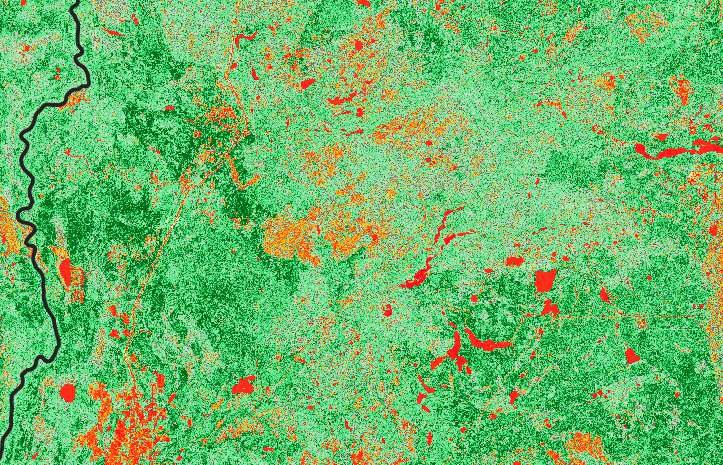
- Continuously updated monitoring, up to five times a year.
- 15 ecological indicators and growing, including wildlife habitat and canopy height.
- Integrates into your existing workflows.
- Up to 700 km of linear features collected in a single day.
- High-resolution imagery in a single flight line.
- AI image classification to support regulatory reporting.
- Single-mobilization collection.
Mandated reporting, without the hassle
- Continuous monitoring reduces cost and resources.
- Data ready for one-, five-, and ten-year reporting.
- Regulatory reporting analytics at your fingertips.
- Decade-by-decade disturbance tracking across a 30-year plan.
What operators gain
- Long-term development certainty.
- Reduced approval cost and timeline.
- Reporting that stays current.
- A 30-year operating advantage.
- Social license to operate.
Questions we hear
What are Alberta’s caribou sub-regional plans?
Alberta’s sub-regional plans manage the footprint of human activity in a sub-region, including roads, oil and gas, timber harvest, seismic exploration, and recreation. They also set expectations for restoring legacy footprint such as seismic lines, and for monitoring whether the plan is achieving its outcomes. Several of them are written to support caribou recovery in the ranges they cover.
Which sub-regional plans has Alberta proposed or completed?
According to the Government of Alberta’s list, they are South Athabasca, Red Earth, Caribou Mountains, Berland, Chinchaga, Bistcho Lake, Upper Smoky, Ghost-Kananaskis, Coal Branch, David Thompson, Wabasca, Slave Lake, and Richardson, plus the completed Livingstone-Porcupine Hills plan. The earlier Cold Lake and Wandering River plans are being folded into the South Athabasca plan.
What is the status of the South Athabasca Sub-regional Plan?
Alberta released a draft in December 2025 and took public input from January 9 to April 9, 2026. Engagement results are under review and updates to the draft are being considered. The plan would replace the Cold Lake Sub-regional Plan and, to be enforceable, its regulatory details would be added to the Lower Athabasca Regional Plan.
What do the plans mean for energy and forestry operators?
In the South Athabasca draft, the area is split into Slow Go, Go, and Restoration First zones, each managed for a different priority outcome. The plan manages the amount of linear footprint from pipelines, transmission lines, and seismic lines, sets restoration expectations that vary by zone, and calls for legacy seismic lines to be restored over forty years. Regulatory details would make specific requirements enforceable, and the regulator would publish information each year for each zone.
Do the plans apply outside South Athabasca?
Yes. South Athabasca is one example. Alberta is preparing sub-regional plans for many areas, each with its own zones and rules, so operators with assets in more than one area need a way to see all of them at once.
How can genesis-ei help me prepare?
genesis-ei already holds a sub-regional baseline and monitors 15 ecological indicators, and growing, including wildlife habitat and canopy height, so you can see how your footprint sits against each plan, plan with the Environmental Priority Pathway, and track disturbance decade by decade. rapid-ortho adds site-specific imagery for linear features, with AI image classification to support regulatory reporting.
Is your operation ready?
Ready to develop with certainty? Request a review of the plan areas your assets sit in.