
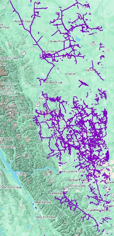
BC dormant pipelines
A GIS inventory of BC dormant pipelines, risk-ranked segment by segment, so you plan restoration, control cost, and reach your Certificate of Restoration inside the 10-year window.
For BC pipeline operators and permit holders. Aligned with the BCER Site Remediation and Restoration Manual, version 1.8, June 2026.
How we solve BC’s dormant pipeline problem
ProDelta maps dormant pipelines and ranks each one by risk and restoration priority, so permit holders can plan the work, file their annual work plan, and show progress. genesis-ei builds the baseline from imagery in minutes, and rapid-ortho documents individual pipelines, processed 100 times faster than traditional imagery processing.
Rules last checked . Most recent change: The BC Energy Regulator’s amendments to the Dormancy and Shutdown Regulation were deposited on March 10, 2026. They moved the annual work plan deadline to November 15 (it was January 30), require restoration reporting to be verified by qualified professionals, and create two tiers of liability reduction plans. Check the amended regulation (B.C. Reg. 112/2019, last amended March 10, 2026) for current timelines. This is a plain-language summary, not legal advice.
- What is the deadline to restore a dormant pipeline in BC?
- Under the Dormancy and Shutdown Regulation, a Type C site must be restored within 10 years of becoming dormant. Dormant pipelines are classified as Type C sites. Permit holders also file an annual work plan for their dormant pipelines.
- What is a Certificate of Restoration?
- The BC Energy Regulator issues a Certificate of Restoration (COR) to certify that a site has been restored to meet regulatory requirements. Part 1 covers site assessment and remediation, and Part 2 covers reclamation and restoration.
Unknown liability. Known deadline.
Pipelines are now part of BC’s dormancy framework. Permit holders file an annual work plan, and a dormant pipeline is a Type C site with a 10-year window to assess it, restore it, and obtain a Certificate of Restoration Part 2.
Why the traditional approach struggles
- Manual file review and database searches don’t scale across thousands of segments.
- Consultant capacity caps how fast your program can move.
- Field inspection is limited to 2 to 5 pipelines a day.
- Significant capital is committed before the scope is known, so management stays reactive.
8,002
Dormant pipelines in BC, in ProDelta’s preliminary inventory.
ProDelta preliminary inventory15,319 km
Estimated total length of those pipelines.
ProDelta preliminary inventory10 years
The restoration window for a Type C site under the Dormancy and Shutdown Regulation.
BC Energy RegulatorBC dormant pipelines GIS file and inventory
ProDelta maintains one of the most complete dormant pipeline inventory data sets available in BC.
It maps 8,002 dormant pipelines, about 15,319 km, in GIS, and links each segment to the ecological and regulatory context you need to rank it. genesis-ei keeps the baseline continuously updated, so the picture does not go stale between filings.
- Segment geometry and dormancy status
- Canopy height and vegetation regrowth, tracked over time
- Moose, caribou, and wolf habitat impact
- Biomass and soil organic matter, compared with the surrounding area
- Watersheds intersected (24) and pipelines in the Montney zone (33)
- A restoration trajectory and a Low to Extreme risk class for every pipeline
Use it to rank your liability, cluster work geographically for capital efficiency, build a multi-year plan around your own priorities, support regulatory reporting, and share clear data with First Nations from day one.
Request a complimentary genesis-ei pipeline inventory review
What the BCER requires
Pipelines have their own requirements in the Dormancy and Shutdown Regulation and the BCER’s Site Remediation and Restoration Manual.
Dormancy and Shutdown Regulation
Dormancy and classification
RegulationA pipeline becomes dormant when it meets the thresholds in the regulation, and its site is classified Type A, B, or C by reference year. Dormant pipelines carry a Type C, 10-year window.
Annual work plan and report
RegulationEvery permit holder with dormant pipelines files an annual work plan for the decommissioning, assessment, and restoration planned each year, and reports on what was done.
Assessment, remediation, restoration
RegulationSections 7 to 9 set the shutdown steps. The Certificate of Restoration closes the process: Part 1 for assessment and remediation, Part 2 for restoration.
Manual: requirements for pipelines
Site screening and file review
Manual, section 7.1.3Permit holder and BCER files, spill records, the site registry, and horizontal directional drilling sump records for the segment.
Aerial and visual assessment of the entire pipeline
Manual, section 7.1.3Historical and new aerial imagery to check vegetation stress, bare or discoloured ground, legacy disturbance, risers, cathodic protection beds, and access points.
Sampling and submission
Manual, Appendix CSoil sampling at every identified area of potential environmental concern, groundwater where results indicate impact, and a site assessment form submission.
Restoration standard by build year
Built or restored before 2020
Standard of the dayRestored to the standard that applied at the time.
2020 to 2023
ESSGMust comply with the Ecologically Suitable Species Guideline, or be on a trajectory to comply.
2024 onward, and any never-restored right-of-way
ESSGMust be fully ESSG-compliant. A dormant right-of-way never previously restored must meet current standards, whatever its construction year.
This is a general summary, not legal advice. genesis-ei and rapid-ortho support qualified professionals and your documentation; decisions remain with the BC Energy Regulator. Confirm requirements with your regulatory team.
A phased approach
Reconnaissance first, ground work only where it is needed. Phases that fit your capacity.
Landscape reconnaissance
genesis-ei baselines your whole portfolio and classifies every pipeline from Low to Extreme, with First Nation priorities built in. Thousands of unranked segments become a prioritized action list, and you can apply for COR Part 1 on low-risk pipelines straight away.
Aerial and historical scouting
Historical aerial photos reveal legacy disturbance. rapid-ortho flights on the prioritized segments confirm current right-of-way conditions, bare areas, vegetation status, and signs of areas of potential concern, and show what ground engagement is actually required.
Engage Nations and the qualified professional
Qualified professionals are engaged only where phases one and two confirm it. Capital goes to your risk-based priorities, First Nations see clear, transparent data and imagery, and screening, investigation, and sign-off finish efficiently.
rapid-ortho can inspect up to 400 pipelines in a single day, with data collection from as little as $150 per pipeline including helicopter costs, and it is designed to support the BCER’s aerial inspection requirement. ProDelta prices per pipeline, with volume discounts.
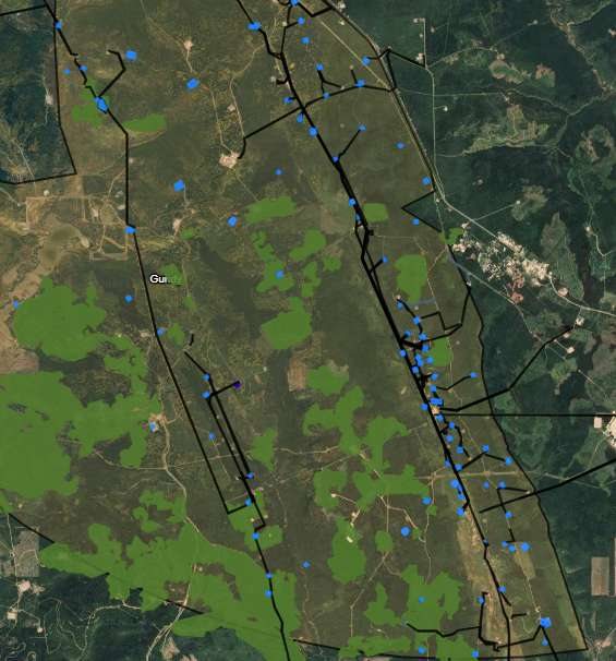
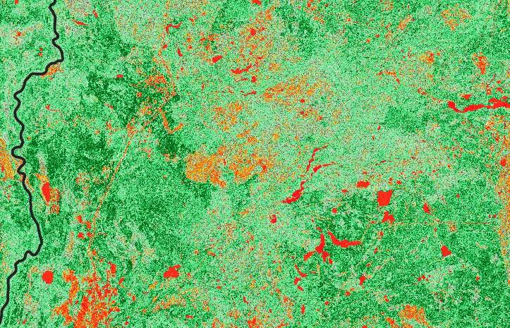
Risk-based assessment: Gundy Creek complex
genesis-ei classified every dormant pipeline in a high-value area of northeast BC, alongside the dormant wells and cut-blocks around them.
| Impact | What it means | Pipelines |
|---|---|---|
| Low | Canopy over 3 m, low habitat impact for moose, caribou, and wolf, and biomass and soil organic matter comparable to the surrounding area. | 3 |
| Moderate | Canopy over 3 m, moderate habitat impact, and biomass and soil organic matter comparable to the surrounding area. | 126 |
| High | Canopy under 3 m, moderate habitat impact, and biomass and soil organic matter not comparable to the surrounding area. | 14 |
| Extreme | Canopy under 1 m, high habitat impact, and biomass and soil organic matter not comparable to the surrounding area. | 4 |
Scouting a pipeline in minutes
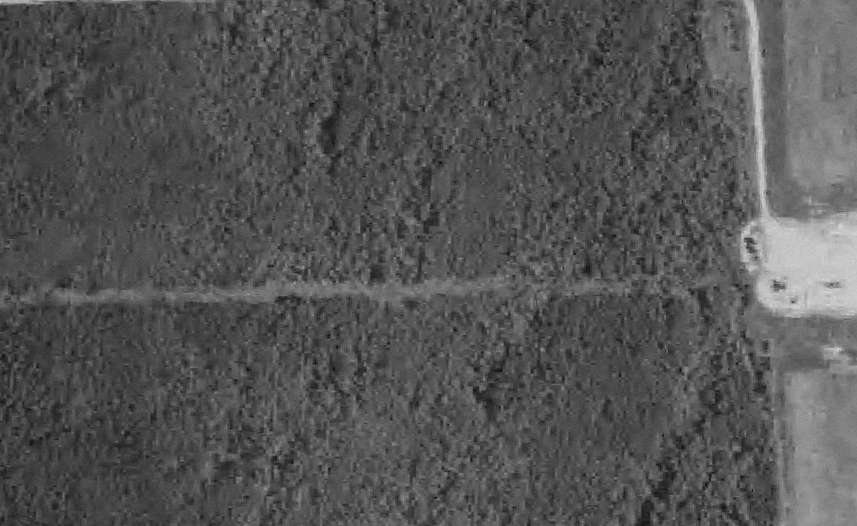
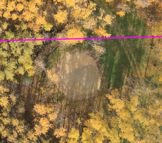
One example, 4 minutes of data collection and a two-week turnaround: classified Low risk, natural growth matching the surrounding area, no risers, operational equipment, or suspected spills identified, and a landowner’s trail to a water source found. Ready for qualified professional review and a COR application.
Questions we hear
Where can I get a BC dormant pipelines GIS file?
The BC Energy Regulator publishes open data through its Data Centre, including dormancy status for wells, facilities, and pipelines, and pipeline right-of-way data, under the BCER Open Data Licence. ProDelta maintains a more complete BC dormant pipelines GIS inventory that adds risk classification, canopy height and regrowth, wildlife habitat, soil organic matter, watersheds, and restoration trajectory for each segment. Operators can request a complimentary inventory review of their own portfolio.
How many dormant pipelines are there in BC?
ProDelta’s preliminary inventory counts 8,002 dormant pipelines, about 15,319 km in total, concentrated in northeast British Columbia. Counts change as pipelines meet the dormancy thresholds and as operators update their records.
What is the deadline to restore a dormant pipeline in BC?
Under the Dormancy and Shutdown Regulation, a Type C site must be restored within 10 years of becoming dormant. Dormant pipelines are classified as Type C sites. Permit holders also file an annual work plan for their dormant pipelines.
What is a Certificate of Restoration?
The BC Energy Regulator issues a Certificate of Restoration (COR) to certify that a site has been restored to meet regulatory requirements. Part 1 covers site assessment and remediation, and Part 2 covers reclamation and restoration.
What does the BCER require to assess a dormant pipeline?
The BCER’s Site Remediation and Restoration Manual calls for site screening and file review, a visual assessment of the entire pipeline using historical and new aerial imagery, sampling at every identified area of potential environmental concern, and submission of a site assessment form.
What is the ESSG?
The Ecologically Suitable Species Guideline (ESSG) is BCER guidance on soil and vegetation objectives for restoration, first released publicly in May 2023. The standard a pipeline must meet depends on when it was built or restored.
How fast can dormant pipelines be assessed?
rapid-ortho can inspect up to 400 pipelines in a single day. In the Gundy Creek examples, data collection took 4 to 6 minutes per pipeline with a two-week turnaround.
Your dormant pipeline liability is unknown. It doesn’t have to stay that way.
Request your complimentary genesis-ei pipeline inventory review.