
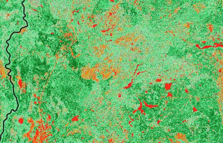
Where your story begins
genesis-ei 2.2
Land planning and monitoring, powered by landscape environmental intelligence. A continuously updated picture of the land, in minutes.
For developers, operators, regulators, and First Nations land teams. Great stories have a great start.
What is genesis-ei 2.2?
genesis-ei 2.2 is ProDelta’s landscape environmental intelligence. It builds a continuously updated baseline of the land from billions of data points, covering 15 ecological indicators and growing, and gives developers, regulators, and First Nations the same evidence for land planning, restoration, and monitoring.
- How fast is it?
- An initial landscape-scale analysis takes minutes, not the months or years of a traditional baseline study. A fully verified baseline for a specific project adds ground truthing by qualified professionals.
- What does it measure?
- Wildlife occupancy for species such as moose, caribou, and wolves, plus species at risk and movement corridors, fish habitat, vegetation health and species, canopy height without LiDAR, biomass, soil organic matter, and restoration priority. The list is 15 indicators today and growing.
Baselines shouldn’t take years
A traditional baseline study is a snapshot that takes months and costs a great deal. genesis-ei is a continuous record that is ready in minutes.
- Data sits in silos, and everyone works from a different map.
- Cumulative effects are hard to see, so they are hard to manage.
- Time-and-material work rewards effort, not outcomes.
Minutes
To a first landscape-scale analysis.
15+
Ecological indicators, and growing.
1980s
History reaches back to the 1980s, so change over time is visible.
What it measures
Fifteen ecological indicators today, and the list keeps growing.
- Wildlife occupancyMoose, caribou, wolves, and species at risk, with corridor tracking.
- Fish habitatStream health, connectivity, and existing impacts.
- Vegetation health and speciesComposition and condition, and wildfire fuel.
- Canopy height, without LiDARMeasured from satellite data.
- Biomass and soil organic matterCompared with the surrounding undisturbed area.
- Restoration priorityMachine learning combined with community and traditional knowledge.
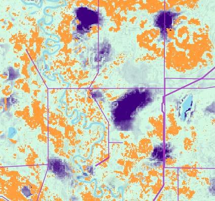
How it works
From imagery and records to a verified, continuously updated picture of the land.
Ingest
Satellite and aerial imagery, including rapid-ortho, plus land and disturbance records.
Analyze
Disturbed areas are compared with undisturbed reference areas to measure recovery and impact.
Predict
It flags risk, shows what is recovering on its own, and shows where intervention matters most.
Monitor
Repeat analysis tracks change over time, so you see actual outcomes, not predictions.
Plan routes and sites
Compare alternative routes or layouts side by side to find the lowest-impact option.
Prioritize restoration
See which areas recover on their own, which need treatment, and where each dollar does the most good.
Find offsets
Identify historical disturbance that can be restored to balance new development.
Monitor continuously
A transparent record over time, supporting adaptive management and reporting.
Specialty modules
genesis-ei is a family. Each module adds tools for a specific industry or land type, and more are coming.
- genesis-aguUtility vegetation monitoring for power lines and other above-ground infrastructure.
- genesis-raven-eyeAI analysis of high-resolution remote sensing for environmental validation, used in mining and pipelines.
- genesis-eagle-eye and genesis-ei windSite-specific bird behaviour analytics and year-round AI wildlife sensors for wind projects.
Where it is used
One baseline, many regulatory questions. genesis-ei supports the evidence behind each of these. Regulators keep the decisions.
- Alberta caribou sub-regional plansFootprint, restoration, and reporting for every plan area.
- BC dormant pipelinesA risk-ranked inventory and a path to a Certificate of Restoration.
- First Nations land planning and project reviewCumulative effects data and project review support, with Two-Eyed Seeing built in.
- Mining, Major Pipelines, and WindEarly environmental validation that reduces regulatory risk and at-risk capital.
How it fits with the other tools
genesis-ei is the understanding. rapid-ortho captures the detail, field-dms holds the field data, geo-story tells the story, and smart-dig resolves the ground.
- Understandgenesis-ei 2.2
Land planning and monitoring, continuously updated.
- Capturerapid-ortho
Fast, high-resolution imagery of corridors and sites.
- Managefield-dms
Field data, collected once and reported anywhere.
- Engagegeo-story
Interactive stories that everyone can review.
- Resolvesmart-dig
3D plume models that design the excavation first.
Questions we hear
What is genesis-ei 2.2?
genesis-ei 2.2 is ProDelta’s landscape environmental intelligence. It builds a continuously updated baseline of the land from billions of data points, covering 15 ecological indicators and growing, and gives developers, regulators, and First Nations the same evidence for land planning, restoration, and monitoring.
How fast is it?
An initial landscape-scale analysis takes minutes, not the months or years of a traditional baseline study. A fully verified baseline for a specific project adds ground truthing by qualified professionals.
What does it measure?
Wildlife occupancy for species such as moose, caribou, and wolves, plus species at risk and movement corridors, fish habitat, vegetation health and species, canopy height without LiDAR, biomass, soil organic matter, and restoration priority. The list is 15 indicators today and growing.
Does it replace consultants, land use plans, or community knowledge?
No. It supports qualified professionals, land use plans, cumulative effects tools, and community knowledge. It handles the repetitive analysis so people can spend time on judgment, relationships, and delivery.
What imagery does it use?
genesis-ei reads satellite imagery and other sources, and can work with aerial imagery from any provider. rapid-ortho is the fastest and highest-resolution option when you need it, but it is not required.
See what genesis-ei finds on your land.
Tell us about the area you care about and we will show you the baseline.