
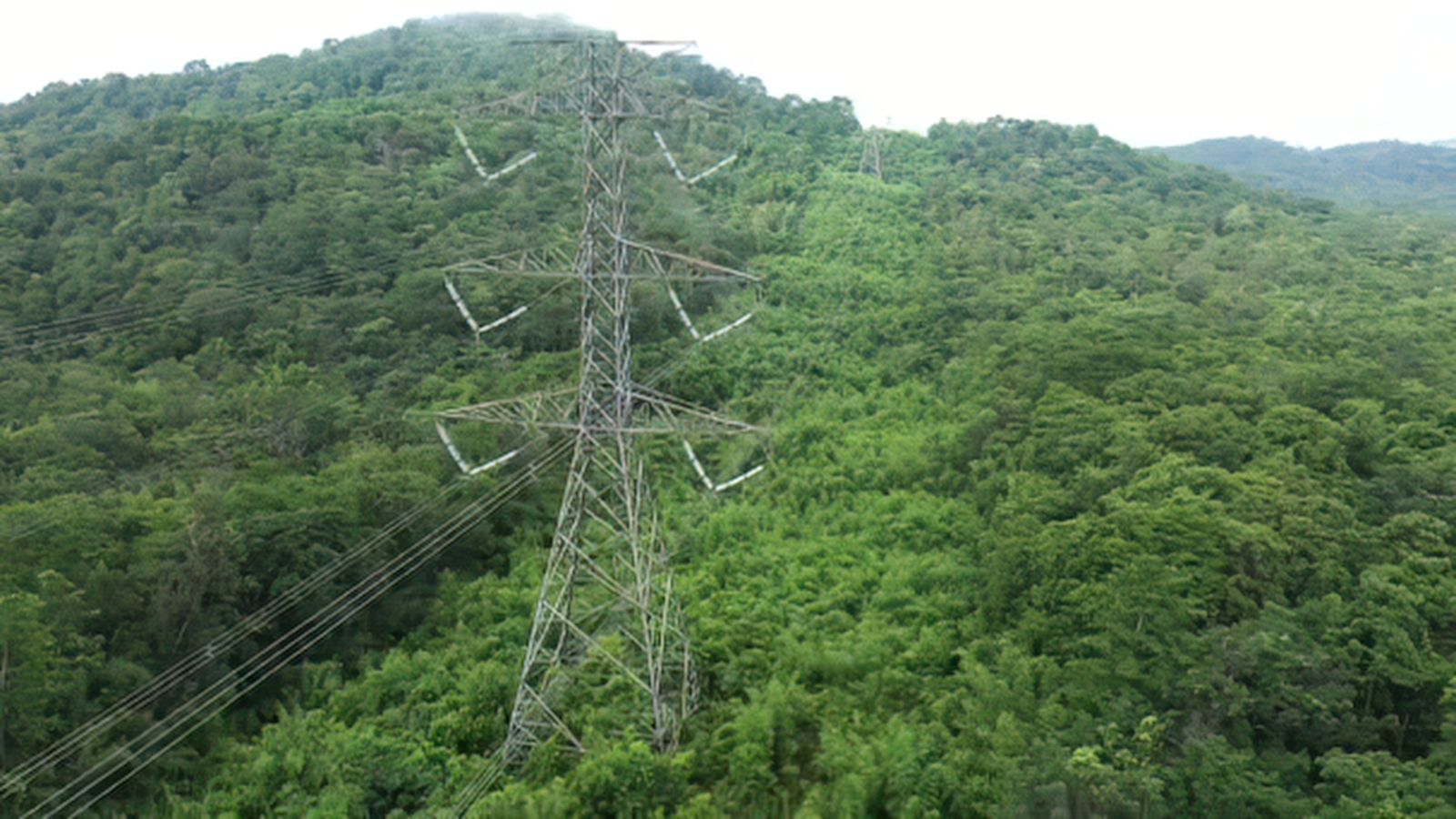
Corridor vegetation management
Know where vegetation threatens your lines, rank the risk parcel by parcel, and focus fieldwork where it matters most.
genesis-agu A module of genesis-ei, ProDelta’s environmental intelligence technology.
Built for energy utilities, municipalities, and communication lines across Canada.
What is genesis-agu?
genesis-agu is a module of ProDelta’s genesis-ei technology. It uses open satellite imagery and artificial intelligence to monitor vegetation along above-ground infrastructure such as power lines, measuring canopy height, species type, vegetation health, and biomass.
- How often is the imagery refreshed?
- Imagery is refreshed up to four times a month, with a maximum refresh rate of 6 to 10 days. Availability after a major weather event depends on satellite location and cloud cover.
- Does genesis-agu require LiDAR?
- No. genesis-agu is built on open satellite imagery from Landsat and Sentinel, so it does not depend on LiDAR collection. Higher-resolution tiers are available for higher-risk areas.
Why it matters
Monitoring a vast linear network is expensive and slow. genesis-agu gives you one continuous view of every line, so fieldwork goes where it is needed.
$10B
Utility companies spend over $10B per year on vegetation management.
T&D World20%
More than 20% of power outages are related to vegetation management.
T&D World18%
Of human-caused wildfires are caused by vegetation and power lines.
Alberta Wildfire Report 2025$850+
Average cost per km for LiDAR collection, across over 1 million km of line.
T&D World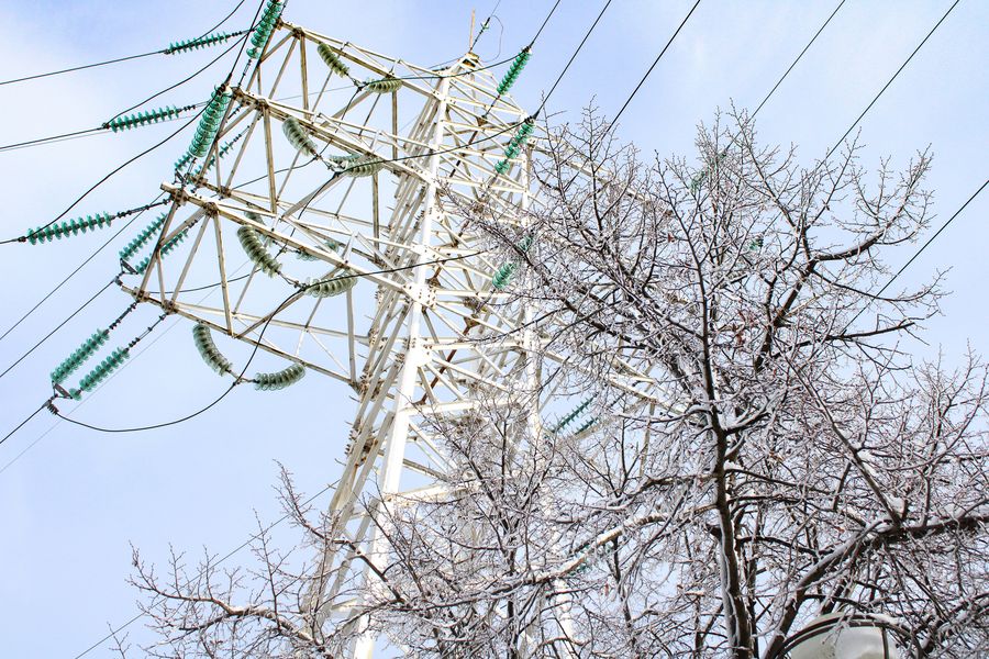
How it works
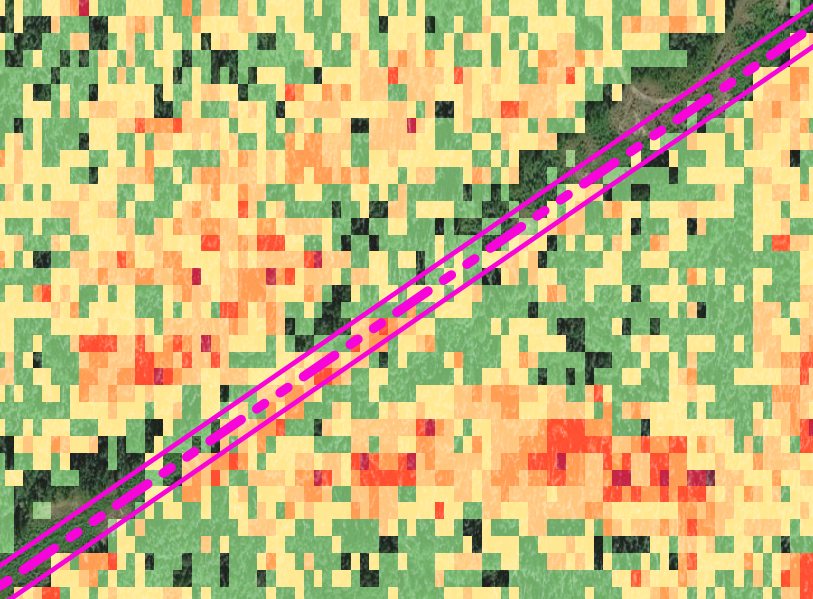
Turn infrastructure data into smarter, lower-cost vegetation management. Monitor every parcel and line continuously, identify risk, and prioritize the work that matters most.
Connect
Overlay your utilities, including the line type and shut-off circuits.
Assess
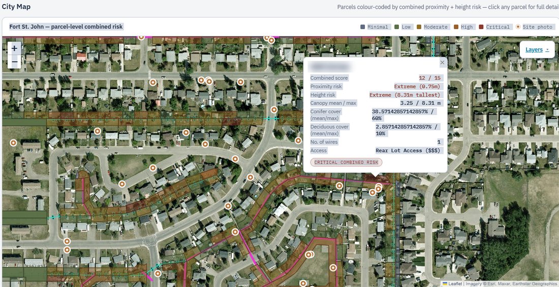
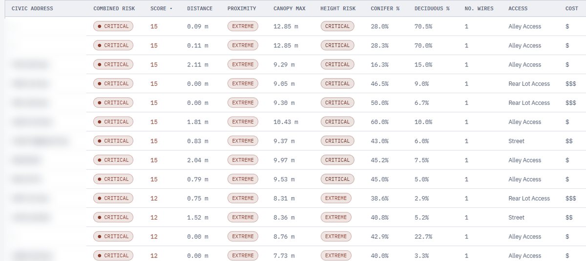
Risk-rank and estimate costs for every parcel and mile.
Prioritize
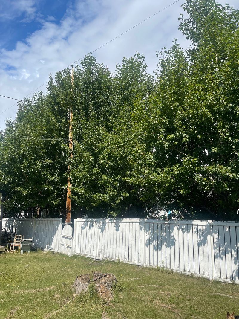
Identify and prioritize your highest-risk areas, with access details.
Act
Execute vegetation control and reduce costs.
What genesis-agu monitors
genesis-agu uses open satellite imagery to monitor your corridors continuously.
- Canopy heightMeasured with a proprietary AI algorithm.
- Species classificationConifer, deciduous, and herbaceous.
- Biomass and vegetation healthSupporting forest fire fuel availability.
- Refresh rateUp to four times a month.
Built on open satellite imagery, so it does not require LiDAR or expensive satellite imagery.
Historical vegetation insights dating back to the 1980s.
- Energy utilities
- Municipalities
- Communication lines
Rules that shape corridor vegetation work in Canada
Requirements differ by province and by who owns the line. These are the main ones this workflow supports with documented, repeatable evidence.
Alberta
Alberta Reliability Standard FAC-003-AB1-1: Transmission Vegetation Management Program
Reliability standardRequires transmission facility owners to run a vegetation management program: documented clearance distances, an annual work plan, tracking of completed work, and reporting of vegetation-related outages. A newer version, FAC-003-AB-5, is listed with a future effective date of January 1, 2028.
Power Line Hazard Assessment Plan
Alberta Wildfire requirementApplies to power lines across Alberta and is part of the pre-application requirements for power line approvals inside the Forest Protection Area. It also informs hazard tree maintenance and right-of-way widening.
Alberta Wildfire Mitigation Strategy (March 2026)
Provincial strategyThe Government of Alberta’s strategy to reduce wildfire risk to communities, forests, and critical infrastructure. It highlights the role utilities play in wildfire mitigation. It is a strategy, not a regulation.
Alberta Utilities Commission review of wildfire mitigation plans
Regulatory reviewThe Commission reviews utility wildfire mitigation plans and costs case by case, and increasingly expects utilities to show formal wildfire risk management practices.
British Columbia
Wildfire Act and Wildfire Regulation
Provincial legislationIndustrial operators, including utility transmission operations, must carry out fire hazard assessments and abatement. An assessment must cover the fuel hazard and the risk of a fire starting or spreading, and must be provided when an official asks for it.
BC Utilities Commission wildfire mitigation planning
Regulatory expectationThe Commission expects utilities to maintain and report on wildfire mitigation planning.
Across Canada
Migratory Birds Convention Act, 1994
Federal lawProtects migratory birds, their nests, and their eggs. Clearing trees and vegetation along lines during the nesting season can destroy nests, so work timing and nest surveys matter. Environment and Climate Change Canada publishes general nesting periods by region.
Species at Risk Act and provincial Wildlife Acts
Federal and provincial lawClearing during the nesting season of birds and mammals can also contravene the Species at Risk Act and the Alberta and BC Wildlife Acts.
How this workflow supports you
- A documented baseline of vegetation height, species, and health along every corridor.
- Change detection back to the 1980s, showing how a corridor has grown over time.
- Risk-ranked parcels and spans, so annual work plans start from evidence.
- A record of what was found, ranked, and treated, ready for regulators and customers.
This page is a general summary and not legal advice. What applies to you depends on who owns the line, where it runs, and what it carries. genesis-agu supports your documentation; compliance remains the line owner’s responsibility. Confirm requirements with your regulatory team.
Part of genesis-ei
genesis-agu is a module of genesis-ei, ProDelta’s environmental intelligence technology. More specialty modules are coming.
Questions we hear
What is genesis-agu?
genesis-agu is a module of ProDelta’s genesis-ei technology. It uses open satellite imagery and artificial intelligence to monitor vegetation along above-ground infrastructure such as power lines, measuring canopy height, species type, vegetation health, and biomass.
How often is the imagery refreshed?
Imagery is refreshed up to four times a month, with a maximum refresh rate of 6 to 10 days. Availability after a major weather event depends on satellite location and cloud cover.
How far back does the history go?
Historical change detection is available, and archives reach back to 1980 where data exists. Coverage is area-specific, and resolution and accuracy vary by area.
Does genesis-agu require LiDAR?
No. genesis-agu is built on open satellite imagery from Landsat and Sentinel, so it does not depend on LiDAR collection. Higher-resolution tiers are available for higher-risk areas.
Which Canadian rules does corridor vegetation management relate to?
Depending on who owns the line and where it runs, the main ones include the Alberta Reliability Standard for transmission vegetation management (FAC-003-AB), Alberta’s Power Line Hazard Assessment Plan, British Columbia’s Wildfire Act and Wildfire Regulation, utility regulator expectations for wildfire mitigation planning, and wildlife protections such as the Migratory Birds Convention Act. genesis-agu supports documentation; compliance remains the line owner’s responsibility.
Who uses genesis-agu?
Energy utilities, municipalities, and communication-line operators who need to monitor vegetation across large linear networks.
Monitor all infrastructure. Reduce fieldwork. Control costs.
See genesis-agu on your own corridors.